 The Itinerary
Chile and Bolivia in 11 days: the Atacama, the lagoon route and Uyuni
Geysers at 4,300m before dawn, a desert that has gone centuries without rain, and then a three-day crossing over the altiplano through flamingo lagoons to a salt pan the size of a small country — one of the great overland borders.
- The Andes
- 11 days
- ≈ AED 7,350 / person
- The driest desert on earth, crossed into the largest salt flat
Before you go
Before you go: the admin
Two entries, and a border in the middle of nowhere
- Most nationalities enter both visa-free — Chile 90 days, Bolivia 30 to 90 depending on passport.
- Bolivia charges US and some other passport holders a reciprocity fee and asks for more paperwork than most countries on this site. Check yours specifically before booking anything.
- A yellow fever certificate is required for parts of Bolivia and is sometimes asked for at the Hito Cajón crossing. Carry it.
- The border post sits at 4,480m, is a hut, and has no facilities. Your tour operator handles the formalities — but have your passport, the Bolivian entry fee in cash if it applies to you, and no expectations of a queue system.
The crossing, which is the route
- San Pedro de Atacama to Uyuni is a three-day 4x4 crossing through the Eduardo Avaroa reserve — lagoons, geysers and refugios, finishing on the salt flat.
- It runs one-way in either direction. Doing it Chile-to-Bolivia means you are climbing, which is kinder on acclimatisation than the reverse.
- It is not a transfer with sights attached. It is three days in a Land Cruiser with five other people, two nights in basic refugios at 4,000m+, and no mobile signal.
Flights
- Fly into Santiago and out of La Paz, open-jaw.
- Santiago to Calama is two hours; San Pedro is another ninety minutes by road.
- Uyuni to La Paz is a 45-minute flight or a ten-hour overnight bus. Fly — the bus arrives at dawn in the cold and wrecks a day.
Altitude, which is the actual constraint
- This is a high-altitude trip from day three. San Pedro is 2,400m, the geysers 4,300m, the lagoon route goes above 4,800m, Uyuni is 3,660m and La Paz 3,600m.
- Acclimatise in San Pedro for two full days before the crossing. It is the whole reason the itinerary starts there.
- Do not fly straight into La Paz and reverse this route without building in acclimatisation days — 3,600m from sea level in a morning catches people out badly.
Money
- Chilean and Bolivian pesos and bolivianos, neither usable in the other.
- Chile is card-friendly almost everywhere. Bolivia is not — cards work in La Paz and almost nowhere else, and ATMs run out at weekends.
- Carry small boliviano notes. Nobody has change for a 100.
- Bring US dollars as a reserve; both change them.
Day by day
Day 1 — Land in Santiago
- Arrive and keep it gentle. Santiago is only 570m, which is the last low night you get on this trip.
- 11:00 — The Museum of Memory and Human Rights if you have a morning — it covers the Pinochet years and is excellent and hard.
- 14:00 — The Mercado Central for lunch, and the seafood is the reason.
- 16:30 — Cerro San Cristóbal by funicular for the whole city under the Andes, which on a clear day is one of the great urban backdrops.
- 19:30 — Barrio Lastarria and Bellavista for the evening.
Day 2 — Fly to Calama, drive to San Pedro
- 09:00 — Two hours north, and the landscape empties completely.
- 13:00 — San Pedro is an adobe village at 2,400m that exists entirely for this desert.
- Do nothing strenuous today. You are acclimatising whether you think about it or not.
- 18:00 — Valle de la Luna at sunset on your first evening — salt caverns, a dune ridge, and the Cordillera de la Sal going pink.
- 21:00 — Book tomorrow’s geysers tonight, and lay out everything warm you own.
Day 3 — The Atacama
- 04:00 — El Tatio geysers at 4,300m, leaving at four in the morning because the fumaroles only plume properly in the cold before sunrise. It is below freezing up there; the thermal pool afterwards is the reward.
- This is 4,300m on your second day. Go slowly, drink more than you want to, and turn back if you feel bad.
- 12:00 — Back in San Pedro, and sleep for an hour.
- 16:00 — Laguna Cejar or the Piedras Rojas in the afternoon — brine pools you float in like the Dead Sea. Rinse afterwards; the salt dries hard on skin.
- 21:00 — Stargazing. The Atacama is the driest non-polar desert on earth and holds most of the world’s major observatories; the amateur tours in San Pedro are genuinely good. They do not run near a full moon.
Day 4 — Valle del Arcoiris, or a rest
- 09:00 — The Rainbow Valley and the Yerbas Buenas petroglyphs, which is a gentler day at lower altitude.
- Or Lagunas Altiplánicas — Miscanti and Miñiques at 4,100m, which doubles as acclimatisation for what is coming. Take this option if you handled El Tatio well.
- 15:00 — Back early either way.
- 17:00 — Rest properly. Tomorrow starts the crossing and the refugios do not sleep well — shared rooms, no heating, and 4,300m.
- 19:00 — Repack into one small bag. The Land Cruisers take six people and the luggage goes on the roof.
Day 5 — Into Bolivia: Laguna Blanca and Laguna Verde
- 07:00 — An early start, the Hito Cajón border at 4,480m, and the change of vehicle to the Bolivian operator’s Land Cruiser.
- 09:00 — Laguna Blanca and Laguna Verde, the latter under Licancabur, a 5,920m volcano with a crater lake near the summit.
- 11:00 — The Dalí Desert — scattered rocks on an empty plain that looks like the paintings and is named for them.
- 13:00 — The Sol de Mañana geysers at 4,850m, which is the highest point of the trip, and the Polques hot springs below.
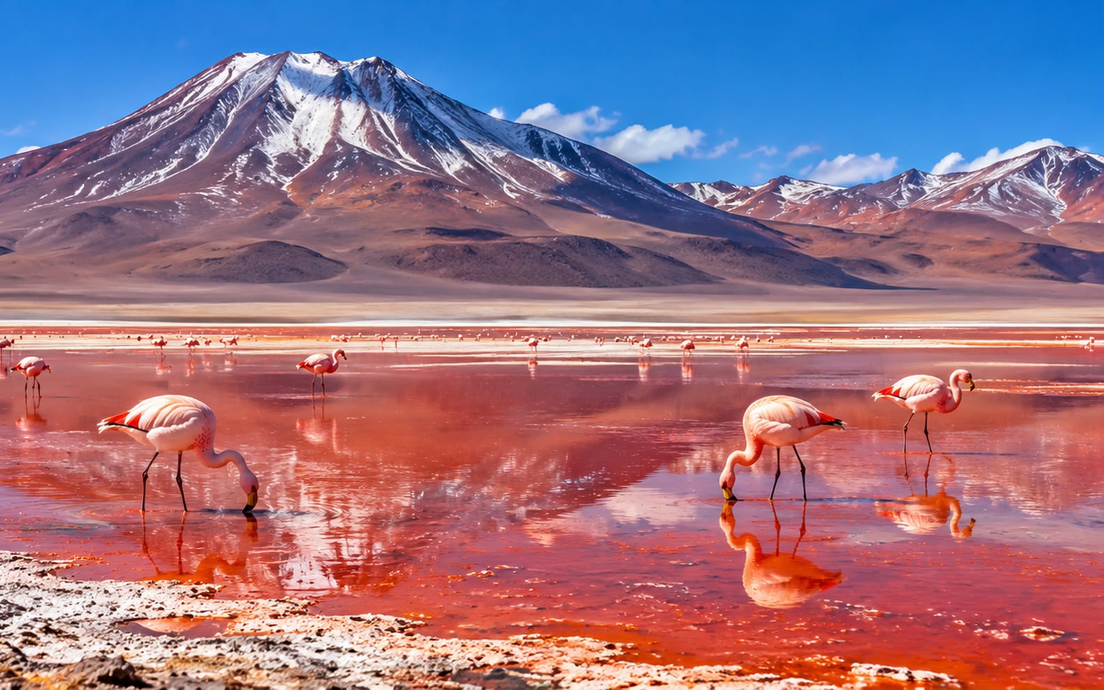
- 17:00 — Laguna Colorada for the night — red with algae, and holding three flamingo species including the rare James’s.
- It drops well below freezing at the refugio. Sleep in your clothes; everybody does.
Day 6 — The Siloli desert and the Árbol de Piedra
- 07:30 — The Árbol de Piedra, a wind-carved rock tree in the Siloli desert.
- 10:00 — The lagoon chain — Honda, Chiarkota, Hedionda, Cañapa — each with flamingos and a volcano behind it.
- 13:00 — The San Cristóbal mine and the Chiguana salt flat.
- 17:00 — A night in a salt hotel on the edge of the salar, where the walls, the floor and the furniture are blocks of salt.
- 19:00 — Sunset over the salt, which from the edge is the best angle of the whole crossing.
Day 7 — The salar de Uyuni
- 05:00 — Out onto the salt before dawn. 10,500km² of it, flat to within a metre across its whole extent, which is why it is used to calibrate satellites.
- 07:00 — Incahuasi island in the middle — a fossil coral outcrop covered in cactus up to twelve metres tall.
- 10:00 — The perspective photographs are the cliché and everybody does them. Bring a prop; the drivers have seen every idea and will direct you.
- In the wet season the salar holds a film of water and becomes a mirror, which is the image people come for and which makes Incahuasi unreachable. You cannot have both — decide which you want before you book the month.
- 15:00 — The train cemetery outside Uyuni town, where the British-built locomotives of the nitrate trade were abandoned.
Day 8 — Fly to La Paz
- 10:00 — Forty-five minutes, and the altiplano from the air is worth the window.
- 12:00 — La Paz is 3,600m and El Alto above it is 4,100m. Arrive slowly and eat lightly.
- 14:00 — The teleférico is public transport, not a ride — ten lines, cheap, and the fastest way across the city. The Red and Yellow lines up to El Alto give the view.
- 17:00 — The Witches’ Market on Linares, which sells llama foetuses for construction blessings and is entirely in earnest. Ask before photographing the stalls.
- 19:30 — Dinner in Sopocachi.
Day 9 — La Paz and the Valle de la Luna
- 08:00 — Tiwanaku as a half-day — the pre-Inca site on the altiplano with the Gate of the Sun, 70km out.
- 14:00 — The Valle de la Luna on the southern edge — eroded clay spires twenty minutes from the centre.
- 16:30 — The Mercado Rodríguez and the Calle Jaén colonial street, which is the one restored block in the city.
- 18:00 — A cholita wrestling night if it is Sunday, which is theatre and is run by the wrestlers themselves.
Day 10 — Death Road, or Lake Titicaca
- 07:00 — The Yungas Road — “Death Road” — by mountain bike, 3,600m of descent from 4,650m into cloud forest. It is a genuine thing people do and the operator matters more than anything else; the cheap ones have a record. Ask about bike maintenance and guide ratios, and pay the difference.
- Or Copacabana and Isla del Sol on Lake Titicaca, four hours out, which is the gentler alternative — and an overnight on the island is better than the day trip.
- 17:00 — Back in La Paz, and the descent to 1,200m and back is its own kind of tiring.
Day 11 — Fly out of La Paz
- El Alto is the highest international airport in the world at 4,061m, and you will feel the walk to the gate.
- 09:00 — A last coffee in Sopocachi, and the drive up to El Alto takes 45 minutes in traffic.
- Leave a buffer day before any onward international connection — Bolivian flights and road blockades both happen, and a blockade can close the airport road entirely.
Costs and practicalities
Best time to visit
The planning tension is the Uyuni mirror, and it is the same trade-off that governs the Peru and Bolivia route.
- May–October (dry) — clear skies, cold nights, reliable roads, and the salar is a hard white plain you drive across with Incahuasi reachable. The lagoon route is at its most dependable. June and July nights at the refugios drop to minus 15°C.
- December–March (wet) — a shallow film of water turns the salar into the mirror. January and February are the most reliable. The trade-off is that Incahuasi is often cut off and parts of the lagoon circuit close.
- April and November — the shoulders, and genuine gambles either way.
- The Atacama is year-round — it is the driest desert on earth — though the altiplanic winter in January and February brings brief afternoon rain that can close the El Tatio road.
Nights are below freezing on the lagoon route in every month. This is not a seasonal warning, it is a constant.
Travel tips
- Acclimatise in San Pedro for two full days before the crossing. The route climbs from 2,400m to 4,850m in two days and the people who struggle are the ones who arrived the day before.
- Go Chile to Bolivia, not the reverse. You climb gradually rather than starting at La Paz’s 3,600m off a long-haul flight.
- Choose the Uyuni operator on safety, not price. The cheap tours have a record of exhausted drivers on long desert stretches, and there is no recovery service out there.
- Carry travel insurance that covers activity above 4,000m. Many policies exclude it, and this route spends three days above that.
- Small boliviano notes. Nothing above 50 is usable in a market or a taxi, and Bolivian ATMs run out at weekends.
- Blockades are a normal political instrument in Bolivia and close roads with little notice. Build slack and ask locally that morning.
- The sun at altitude burns through cloud, and the salar reflects from below. SPF 50, sunglasses, lip balm, and people still burn under the chin.
What this trip actually costs
Two people, 10 nights, mid-range comfort, international flights excluded:
| Item | Cost |
|---|---|
| Hotels and refugios, 10 nights | USD 1,400 (≈ AED 5,142) |
| Three-day Uyuni crossing, two people | USD 900 (≈ AED 3,305) |
| Santiago–Calama and Uyuni–La Paz flights, two people | USD 700 (≈ AED 2,571) |
| Atacama excursions: El Tatio, Valle de la Luna, stargazing | USD 500 (≈ AED 1,836) |
| Food and drink, 11 days | USD 500 (≈ AED 1,836) |
| Total for two | USD 4,000 (≈ AED 14,690) |
- Roughly USD 2,000 (≈ AED 7,345) per person, and Chile is substantially the dearer half — San Pedro is a resort village with resort prices.
- The three-day crossing is the best value on the page — transport, accommodation, meals and the two best days of the trip.
- Flying La Paz rather than taking the night bus costs about $200 more for two and saves a wasted day.
- Hotel picks here are chosen on location, not on commission — always check prices and recent reviews before booking.
What to pack
- A proper warm jacket, hat and gloves. The refugios at 4,000m+ are unheated and the nights are below freezing in every month.
- A sleeping bag liner, and a bag rated for cold if you have one — the refugio blankets are thin.
- Layers for 25°C days and minus 10°C nights, often the same day.
- Sunglasses and SPF 50, used relentlessly.
- A head torch. Refugio power runs for a couple of hours in the evening.
- Small notes in bolivianos and US dollars as a reserve.
- Wet wipes. There are no showers worth the name for three days.
FAQ
Dry season or wet season? Wet, if the mirror is what you came for — January and February are the most reliable. Dry, if you want Incahuasi and the full lagoon circuit. You cannot have both.
Which direction? Chile to Bolivia. You acclimatise gradually in San Pedro rather than starting at La Paz’s altitude straight off a flight.
How rough is the three-day crossing? Basic. Six to a Land Cruiser, two nights in unheated refugios above 4,000m, no showers, no signal. It is also the best part of the trip and nobody regrets it.
Can I combine this with Peru? Yes — La Paz to Copacabana and across to Puno is a standard route, and the Peru and Bolivia guide picks up from there. Add a week.
Is the altitude dangerous? It is serious rather than dangerous if you acclimatise. Two nights in San Pedro before the crossing, water, no alcohol, and descend if symptoms appear rather than pushing on.
Prices and entry rules change, and what you need depends on your passport; last checked 29 October 2026, so confirm with the embassy or your airline before booking.


