 The Itinerary
Tajikistan in 11 days: the Pamir Highway, Khorog and the Wakhan
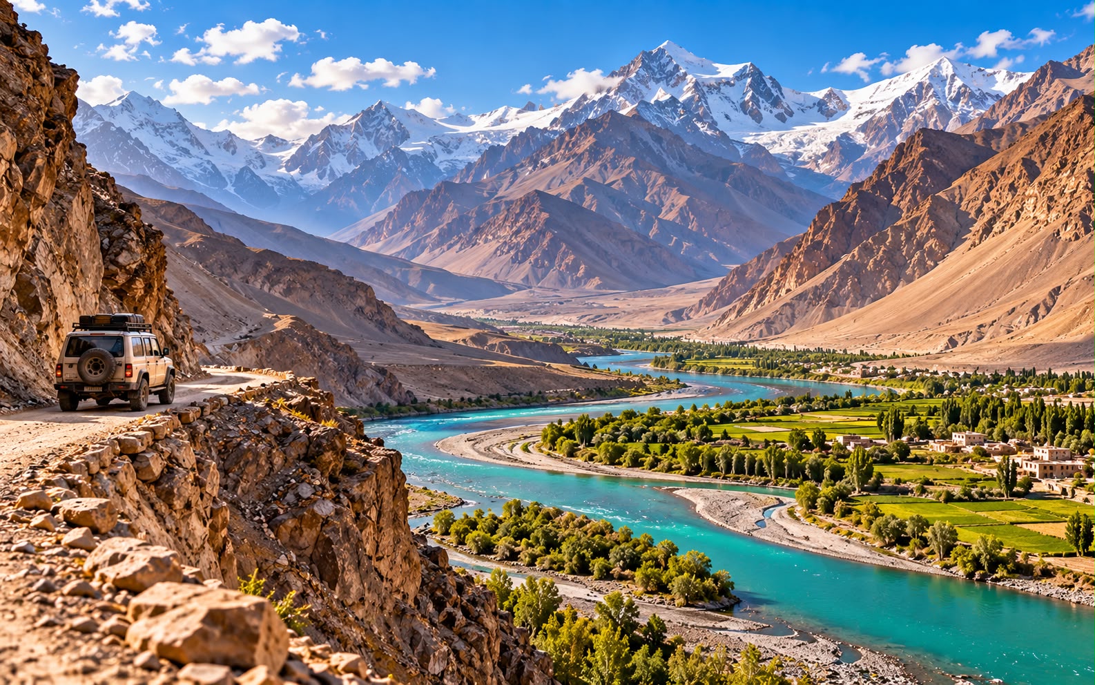
The M41 runs from Dushanbe to Kyrgyzstan across a 4,655-metre pass, along a river with Afghanistan on the far bank for three days, past hot springs and Silk Road forts and a lake made by a meteorite — and it needs a permit, a 4x4 and a tolerance for altitude that most road trips do not ask for.
- Central Asia
- 11 days
- ≈ AED 5,600 / person
- The second highest road on earth
Before you go
The Pamir Highway — the M41 — is the second highest road in the world, built by Soviet engineers in the 1930s to supply a border that mattered. It crosses the Ak-Baital pass at 4,655 m, runs for days above 3,500 m, and for one long stretch the Panj river is the only thing between you and Afghanistan, close enough to see children walking to school on the far bank.
This is not a comfortable trip. The road surface ranges from tarmac to riverbed, the altitude is genuinely high, and the infrastructure is homestays and shared toilets. It is also one of the great overland journeys left, and the Pamiri hospitality along it is unlike anything else in Central Asia.
Read the permit and the security sections before you book anything.
Before you go: permits, altitude and the honest caveats
The GBAO permit, and the security position
- The Pamirs lie in Gorno-Badakhshan (GBAO), an autonomous region, and you need a separate GBAO permit on top of your visa. It is applied for with the e-visa or added in Dushanbe, and it is checked at posts along the road.
- Be realistic about this: GBAO has seen periods of unrest and the permit has been suspended or restricted at times, with roads closed at no notice. Check your government’s current travel advice before booking, and check again before you fly.
- Carry several photocopies of passport, visa and permit — checkpoints keep them.
- Work with a Dushanbe agency or a Pamiri driver who knows the current position. They will know what has changed this month, which no guidebook can.
Altitude is the real constraint
- You sleep at 3,600 m in Murghab and cross 4,655 m at Ak-Baital. This itinerary goes west to east, gaining altitude gradually over days, which is the correct direction for acclimatisation.
- Do not reverse it to save a flight unless you have time to acclimatise at the eastern end.
- Expect headaches and broken sleep at Murghab and Karakul. Drink constantly, eat lightly, and go down if symptoms get worse rather than better.
The vehicle and the season
- A 4x4 with a driver is the only sensible way. Shared jeeps exist and are cheap; a private vehicle costs more and buys you the ability to stop.
- June to September is the season. July and August are the most reliable, with the passes clear.
- October to May the high passes close with snow, and much of the Wakhan becomes impassable. Late May and early October are a gamble.
- Expect punctures, breakdowns and river crossings. The driver will fix them; a day’s delay is normal and should be in your plan.
Money, fuel and food
- Somoni (TJS). Draw everything in Dushanbe — there is an ATM in Khorog that sometimes works and effectively nothing after it. Carry USD as backup.
- No card payment anywhere east of Khorog.
- Homestays are the accommodation: a room, a shared squat toilet, often no shower, and dinner with the family. They cost very little and they are the best part of the trip.
- Vegetarians should carry supplements — the diet east of Khorog is bread, rice, potato and mutton.
Day by day
Day 1 — Land in Dushanbe
- 05:00 — Most flights land in Dushanbe before dawn, which is the one unhelpful thing about arriving.
- 10:00 — Dushanbe is low, green and startlingly orderly — wide Soviet avenues, fountains, and one of the tallest flagpoles in the world on Rudaki.
- 11:00 — Confirm the GBAO permit if you are collecting it here, and meet your driver.
- 13:00 — Lunch, then the National Museum of Antiquities for the 13-metre reclining Buddha from Ajina-Tepe — the largest in Central Asia, and a reminder that this was Buddhist long before it was Muslim.
- 16:00 — Rudaki Park and the Ismoil Somoni monument.
- 17:30 — Mehrgon or Green Bazaar for the week’s supplies: dried fruit, nuts, bottled water and anything you will want that a village shop will not have.
- 19:30 — Dinner — qurutob, torn bread with yoghurt sauce and onion, eaten communally by hand from a shared platter.
- 21:00 — Sleep early. Tomorrow is a long one.
Day 2 — South to the Panj
- 06:00 — Leave early. Dushanbe to Kalaikhum is 10 to 14 hours depending on the route and the road.
- 09:00 — The Shurobod pass route goes over 3,200 m; the northern Tavildara route is longer and sometimes closed. Your driver will choose on the morning.
- 13:00 — Lunch at a roadside chaikhana.
- 15:00 — And then the Panj. The road drops to the river and Afghanistan begins on the far bank, fifty metres away — villages, terraced fields, donkeys on a footpath cut into the cliff, and people who look across at you. It stays that way, on and off, for the next three days, and it is the thing nobody forgets.
- 18:00 — Kalaikhum (Darvoz), a strip of houses along the river.
- 19:30 — First homestay dinner, and the first of a great many cups of tea.
Day 3 — Up the Panj to Khorog
- 07:00 — The river road to Khorog, seven to nine hours and spectacular the whole way.
- 09:00 — The road is cut into the gorge wall with the river below and Afghanistan opposite. In places the Afghan side has only a footpath; in others a surprisingly good Chinese-built road.
- 12:30 — Lunch wherever there is somewhere.
- 16:00 — Khorog, the GBAO capital at 2,200 m, sitting in a bowl where the Gunt meets the Panj. It is small, educated and has the feel of a frontier university town — the University of Central Asia is here.
- 17:30 — The botanical garden above the town, the second highest in the world at 2,320 m.
- 19:00 — Dinner, and this is where you draw cash and buy anything you still need. After Khorog there is very little.
Day 4 — Into the Wakhan
- 08:00 — Turn south into the Wakhan corridor, the finger of Afghan territory that the British and Russians left between their empires in 1895 specifically so they would not share a border.
- 10:00 — Garam Chashma hot springs if you detour, or straight on along the valley as it opens out and the Panj slows.
- 12:00 — Yamchun Fortress, a 3rd-century BC Silk Road fort on a spur 500 m above the valley, with walls and towers still standing and a view down both ways.
- 13:30 — Bibi Fatima hot springs just above it — hot mineral water in a cave pool, and the local belief is that it helps women conceive. Men and women bathe separately.
- 16:00 — Langar, at the eastern end of the Wakhan, with thousands of petroglyphs on the rocks above the village — ibex, horsemen and hunting scenes going back several thousand years.
- 18:00 — Homestay. Look south: the Hindu Kush stands across the valley in Afghanistan, 6,000 m and snow-covered.
Day 5 — The Wakhan, and up onto the plateau
- 07:30 — Vrang and its Buddhist stupa, cut into the hillside and dating to the 4th century.
- 09:30 — The valley narrows and the road begins to climb away from the river. You are leaving Afghanistan behind and gaining a thousand metres.
- 12:00 — Khargush pass at 4,344 m, and a landscape that changes completely: no trees, no villages, just high desert, wind and enormous distance.
- 14:00 — Join the main M41, and the salt lakes.
- 16:00 — Bulunkul and Yashilkul — the first a village of about forty families at 3,700 m recorded as the coldest inhabited place in Tajikistan, the second a long turquoise lake below it.
- 18:00 — Homestay at Bulunkul. It will be cold, the toilet will be outside, and dinner will be fish from the lake.
- 21:00 — The stars. 3,700 m, no moisture, no light for a hundred kilometres.
Day 6 — Murghab
- 08:30 — East on the M41 across the plateau to Murghab, the highest town in Tajikistan at 3,618 m.
- 11:00 — The landscape is Tibetan rather than Central Asian — ochre, treeless, with yak and Kyrgyz yurts, because the population out here is ethnically Kyrgyz, not Tajik.
- 12:30 — Arrive. Take it very easy today. This is the altitude night most people feel.
- 14:00 — The container bazaar — a market made of shipping containers, which is exactly as bleak and functional as it sounds and is the town’s centre of gravity.
- 16:00 — A short walk, slowly, and no more.
- 18:30 — Dinner at the homestay.
- Note — Headache and poor sleep here are normal. Water, no alcohol, and tell your driver if you feel worse rather than better.
Day 7 — Ak-Baital and Karakul
- 08:00 — North, and up. The Ak-Baital pass at 4,655 m is the highest point on the Pamir Highway and the second highest road pass in the world. The air at the top is thin enough that walking twenty metres leaves you breathless.
- 10:00 — Over, and down onto the Karakul basin.
- 11:30 — Lake Karakul, 3,900 m, 25 km across, intensely blue and ringed by white peaks. It sits inside a 45 km meteorite impact crater, about 25 million years old, and the lake is saline and frozen for much of the year.
- 13:00 — The village of Karakul on the shore: a few dozen houses, yaks, and the Chinese border fence visible to the east.
- 15:00 — Walk the shore. Nothing grows and nothing moves except the wind.
- 18:00 — Homestay, and this will be the coldest night.
Day 8 — Back toward Murghab, or on to Kyrgyzstan
- Option A — continue north. The Kyzyl-Art pass at 4,280 m and the Kyrgyz border, then down to Osh — which is how most people finish the highway, and it pairs directly with our Kyrgyzstan guide. If you are doing this, today is a border day and the trip ends in Osh.
- Option B — turn back, 08:00. Return south to Murghab and then west, which is this itinerary — you see the plateau in the other light and it is a genuinely different drive.
- 12:00 — Pshart or Madiyan valley for the yurt camps, and the Marco Polo sheep if you are lucky with binoculars.
- 16:00 — Murghab.
- 19:00 — Dinner, and a shower if one is available, which it may not be.
Day 9 — Back to Khorog
- 07:30 — West on the M41, the direct route this time rather than the Wakhan, over the Koi-Tezek pass at 4,271 m.
- 11:00 — Jelondy hot springs on the way down, which is a Soviet-era sanatorium and a very welcome bath.
- 14:00 — The descent into the Gunt valley, losing 2,000 m, and trees reappear.
- 16:30 — Khorog. After a week above 3,500 m, 2,200 m feels like sea level and you will sleep properly for the first time in days.
- 18:00 — The Khorog park, a shower, and a beer.
- 19:30 — Dinner, and settle up with the driver.
Day 10 — Fly or drive to Dushanbe
- Option A — fly, 07:00. The Khorog–Dushanbe flight is 45 minutes in a small aircraft that flies between the peaks rather than over them, and it is one of the most spectacular short flights anywhere. It only goes in good weather and is cancelled often — treat it as a bonus, not a plan.
- Option B — drive, 06:00. Back down the Panj, 14 to 16 hours, and a long day.
- 19:00 — Dushanbe. A hotel with a proper bathroom, which after ten days will be memorable.
- 20:30 — Dinner somewhere with a menu.
Day 11 — Fly home
- Morning — The Hissar Fortress, 30 km west, if your flight is late — a restored gateway and madrasas on a hill.
- Afternoon — Dushanbe airport is close to the centre.
- Note — Keep the GBAO permit until you have left the country; it is occasionally asked for again.
Costs and practicalities
Best time to visit
June–September, and the window is dictated entirely by the Pamir passes — the Ak-Baital at 4,655m and the Khargush are snowbound outside it.
- June–September — the only reliable season for the Pamir Highway. July and August are warmest, with the high valleys green and the Wakhan accessible.
- May and October — possible at the margins, with snow on the passes a real risk and lake ice at Karakul lingering into June.
- November–April — the Pamirs are effectively closed. The highway can be blocked for weeks, homestays shut, and the Bartang is impassable.
- The Fann Mountains and Iskanderkul have a slightly longer season, roughly June to October.
Dushanbe and the lowlands are hot in summer, over 35°C, and mild in winter — the opposite problem to the mountains.
Travel tips
- A GBAO permit is required for the Pamirs and is applied for with the e-visa. Without it you will be turned back at the Gorno-Badakhshan checkpoint.
- Check the security position in GBAO before committing. The region has had periods of unrest and road closures, and the permit has been suspended at times.
- The Pamir Highway is a 4x4 and driver proposition. Shared transport exists but is slow and unreliable; most travellers hire a vehicle and driver for the whole run.
- Altitude is serious. Murghab is 3,650m and the Ak-Baital pass 4,655m. Ascend gradually from Khorog and take the first days slowly.
- Carry cash in somoni, and US dollars to change. There are ATMs in Dushanbe and Khorog and nothing in between.
- Homestays are the accommodation along the highway and are the best part of the trip. Cash, basic, and genuinely hospitable.
- Fuel and spare parts are scarce beyond Khorog. A good driver carries both.
What this trip actually costs
Two people, 10 nights, homestays and one Dushanbe hotel, excluding international flights:
| Item | Cost |
|---|---|
| 4x4 with driver, 9 days, including fuel | TJS 13,500 (≈ AED 5,384) |
| Homestays, 8 nights, two people, half board | TJS 5,600 (≈ AED 2,233) |
| Dushanbe hotel, 2 nights | TJS 2,400 (≈ AED 957) |
| GBAO permits and visas, two people | TJS 1,300 (≈ AED 518) |
| Food, water and supplies beyond half board | TJS 3,000 (≈ AED 1,196) |
| Hot springs, sites, tips, extras | TJS 2,200 (≈ AED 877) |
| Total for two | TJS 28,000 (≈ AED 11,166) |
- Roughly TJS 14,000 (≈ AED 5,583) per person — about USD 1,300, which for eleven days is remarkable value given what it is.
- The vehicle is half the cost and it is the one thing not to economise on. A shared jeep halves it and removes your ability to stop anywhere.
- Homestays are extraordinarily cheap and the money goes directly to the families.
- The Khorog–Dushanbe flight would add about TJS 1,400 (≈ AED 558) for two and save a 16-hour drive.
What to pack
- A sleeping bag liner, and a sleeping bag if you feel strongly about it. Homestay bedding is clean and heavy and shared.
- Serious warm layers. Nights at Karakul drop below freezing in July.
- Altitude medication if your doctor advises it, and a plan for what you do if symptoms worsen.
- All your cash, in somoni and USD, drawn in Dushanbe.
- Water purification — tablets or a filter bottle. Bottled water runs out east of Khorog.
- Toilet paper, wet wipes and hand sanitiser. There are no shops.
- A power bank. Electricity is intermittent and often only in the evening.
- Lip balm and sun cream. At 4,000 m the sun is brutal and the air has no moisture in it at all.
FAQ
Is it safe? The road itself is safe in the ordinary sense — the risks are altitude, driving and remoteness rather than people, and Pamiri hospitality is remarkable. But GBAO has had periods of unrest, permits have been suspended, and roads have closed at no notice. Check your government’s current advice before booking and again before flying, and use an operator who knows this month’s position. This is the one guide on this site where that caveat is not boilerplate.
How bad is the altitude? You sleep at 3,600 m and cross 4,655 m. Most people get headaches and sleep badly for two or three nights. Going west to east, as this itinerary does, gains the height gradually and is much kinder than the reverse.
Can I do it without a private vehicle? Shared jeeps run the route and cost a fraction. You give up every stop that is not where the driver is already going — which means most of the Wakhan, Bulunkul and the fortresses. On a once-in-a- lifetime drive, hire the vehicle.
Should I finish in Kyrgyzstan? Many people do, crossing at Kyzyl-Art to Osh, and it is the natural end of the highway. It also pairs neatly with our Kyrgyzstan guide for a three-week Central Asia trip.
When is the season? June to September, with July and August the most reliable. Outside it the high passes are closed by snow and the Wakhan road is impassable.
Prices and entry rules change, and what you need depends on your passport; last checked 8 October 2026, so confirm with the embassy or your airline before booking.


