 The Itinerary
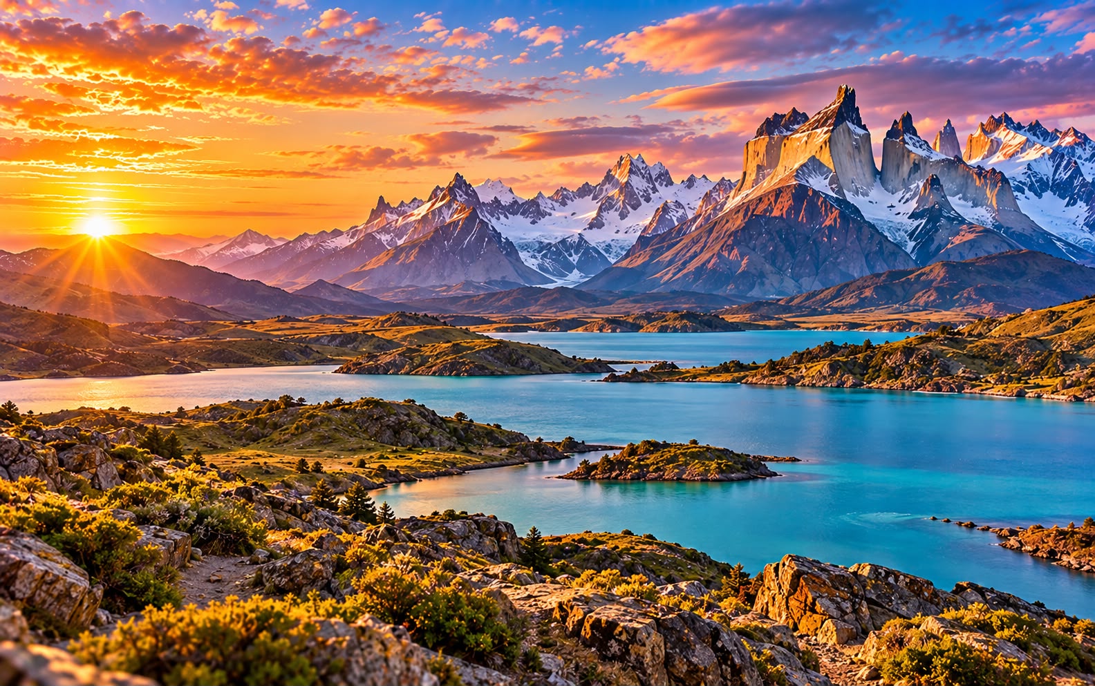
Chile in 12 days: the Atacama, Santiago and Torres del Paine
The longest country on earth, at both ends: a desert so dry parts of it have no recorded rain, salt flats with flamingos, and granite towers above a turquoise lake at the bottom of the world — with the altitude order, the park bookings that sell out months ahead, and the two flights that make it possible in twelve days.
- Southern Cone
- 12 days
- ≈ AED 10,150 / person
- Desert + Patagonia
Before you go
Chile is 4,300 km long and never more than 350 km wide, which makes it the most absurd country to plan and one of the most rewarding to visit. This trip takes the two ends and skips almost everything between, because the two ends are extraordinary and the middle is a long drive.
The Atacama is the driest non-polar desert on earth — salt flats with flamingos, geysers that erupt at dawn, and a night sky so clear that the world’s major observatories are built here. Torres del Paine is the other end: granite towers over glacial lakes, guanacos on the steppe, and wind that has its own reputation.
Santiago sits in between, worth two days rather than five.
Two internal flights make this work. Without them it is a three-week trip.
Before you go: altitude, bookings and the wind
Entry, and the seasons at both ends
- Most nationalities enter visa-free for 90 days — the EU, UK, US, Canada, Australia and most of Latin America.
- Chile’s agricultural controls are strict and enforced. Declare all food, seeds, wood and plant material on arrival; fines are substantial and the dogs are good.
- The seasons are inverted, and the two ends disagree. Patagonia works November to March and shuts down outside it. The Atacama works year-round, though January and February bring the “Bolivian winter” — brief afternoon storms that can close roads.
- December to February is Patagonian peak: best weather, most people, highest prices, refuges booked out.
- November and March are the sweet spot — the park open, the wind slightly less relentless, prices lower.
The altitude catches people out
- San Pedro de Atacama sits at 2,400 m, and the excursions go much higher — the geysers at 4,300 m, the altiplano lagoons above 4,000 m.
- Do not do the geysers on your first morning. Give yourself a day at San Pedro’s altitude first. The guide below sequences it that way deliberately.
- Drink far more water than feels necessary; the humidity here is close to nil and you dehydrate without noticing.
Torres del Paine needs booking months ahead
- Park entry is now booked online in advance and capped. Buy it before you arrive; it is not reliably available at the gate.
- If you are trekking the W or the O circuit, the refuges and campsites sell out months ahead — often by August for the following January. They are run by two separate concessions plus the park service, and you book each separately, which is the single most annoying part of planning Chile.
- If you are not trekking, day walks from a hotel outside the park need no booking beyond entry, and this itinerary assumes that.
- The wind is the real weather. It routinely exceeds 100 km/h in spring and can stop a walk. Check the forecast each morning and believe it.
Money and getting around
- The peso (CLP), and prices run to the tens of thousands. Fix a mental conversion on arrival.
- Cards work in cities and hotels. Carry cash in San Pedro and in Patagonia, where some operators and small places are cash only.
- Internal flights — Santiago to Calama for the Atacama, and Santiago to Punta Arenas for Patagonia — are the itinerary. Book early; they rise sharply.
- Punta Arenas to Puerto Natales is a three-hour bus, frequent and comfortable.
- Hiring a car in Patagonia gives freedom the buses do not, and is worth it if you are confident on gravel.
Day by day
Day 1 — Land in Santiago
- 13:00 — Land at Arturo Merino Benítez (SCL), 20 km from the centre. Use the official Transvip or Turbus desks rather than the touts.
- 14:30 — Stay in Lastarria for the cafés and museums or Providencia for a quieter residential base. Both are safe to walk; avoid leaving valuables visible anywhere, which is the standing advice for Santiago and is meant.
- 16:00 — Walk Barrio Lastarria and the Parque Forestal.
- 18:00 — Cerro Santa Lucía, the small hill the city was founded on in 1541, for the first look at the Andes behind the skyline.
- 20:00 — Dinner. Chile eats earlier than Argentina and later than Europe — around nine. Pisco sour first, and it is Chilean, whatever Peru says.
Day 2 — Santiago
- 09:00 — Cerro San Cristóbal by the 1925 funicular, 300 m above the city, with the Virgin at the top. Go early: the smog sits in the basin and the Andes are only visible on clear mornings, usually after rain.
- 11:00 — The Museo Chileno de Arte Precolombino, which is small, beautifully done, and the best museum in the country — Chinchorro mummies older than Egypt’s, and Andean textiles.
- 13:00 — Mercado Central for lunch: congrio or reineta at a counter in the 1872 iron hall, with machas a la parmesana to start.
- 15:00 — Museo de la Memoria y los Derechos Humanos, on the Pinochet dictatorship. It is unflinching and it is the context for a great deal else.
- 17:30 — Barrio Bellavista and La Chascona, one of Neruda’s three houses, built for Matilde and as eccentric as the others.
- 20:00 — Dinner in Bellavista or the Lastarria wine bars.
Day 3 — North to the desert
- 08:00 — Fly to Calama, two hours.
- 10:30 — The transfer to San Pedro de Atacama, an hour across gravel plain with the volcano line ahead.
- 12:00 — San Pedro is a single-storey adobe village at 2,400 m, and it is the altitude that shapes the next three days.
- 13:00 — Lunch, then do nothing strenuous. Tomorrow goes above 4,000 m and the day after to 4,300 m; today is acclimat- isation whether you feel you need it or not.
- 15:30 — Walk the village: the adobe church, the Gustavo Le Paige museum, and the one main street.
- 17:00 — Valle de la Luna for sunset — salt-crusted badlands, the Three Marias, and the amphitheatre, with the Licancabur volcano turning red opposite as the sun drops.
- 20:00 — Dinner, and drink more water than you want to.
Day 4 — Salt flats and flamingos
- 08:00 — Laguna Chaxa in the Salar de Atacama, Chile’s largest salt flat. Three flamingo species — Andean, Chilean and James’s — feed here on brine shrimp, on a crust that cracks and tinkles underfoot.
- 11:00 — Back for the heat of the day.
- 14:30 — The altiplano lagoons — Miscanti and Miñiques — at over 4,100 m: two deep blue lakes under snow-streaked volcanoes, with vicuña grazing the shore. This is why yesterday was a rest day; walk slowly up here and expect to be breathless.
- 17:00 — Toconao village on the way back, with its separate bell tower in white volcanic stone.
- 21:30 — Stargazing. The Atacama has the clearest skies on earth and most of the world’s major observatories; the small tours run by local astronomers with their own telescopes are genuinely good — Saturn’s rings, the Magellanic Clouds, and the Milky Way bright enough to read by.
Day 5 — Geysers, at dawn
- 04:00 — Leave for El Tatio. It is brutal and it is necessary: the geyser field is 4,320 m, the eruptions are at their most dramatic in the cold before sunrise, and by nine the columns have largely collapsed.
- 06:30 — Arrive. It will be −10°C or colder. Eighty geysers and a hundred fumaroles across a basin, with steam columns catching the first sun. Stay on the marked paths — the crust is thin, the water is at boiling point, and people have been badly scalded.
- 08:30 — Breakfast cooked on a vent, then the hot springs at the edge of the field if you brought a swimsuit and the nerve to change in that cold.
- 10:30 — Down, stopping at Machuca village and the vicuña wetlands.
- 13:00 — Back in San Pedro. Sleep.
- 17:00 — The Valle del Arcoíris or the Quebrada de Jerez, if you have anything left.
Day 6 — South, the long way
- 08:00 — Transfer to Calama, then fly to Santiago, two hours.
- 12:30 — Santiago. This is the one heavy travel day — the country is 4,300 km long and you are crossing most of it.
- 15:00 — Connect on to Punta Arenas, three and a half hours more. If the timings do not work, overnight in Santiago rather than risking it; Patagonian flights are weather-dependent and missing one costs a day.
- 19:00 — Arrive at the bottom of the continent. It is cold, windy, and light until very late in summer.
- 20:30 — Dinner. King crab — centolla — is the local speciality and in season it is extraordinary.
Day 7 — To Puerto Natales
- 09:00 — Bus north, three hours, along the Strait of Magellan and out onto open steppe — rheas, guanacos, and nothing else.
- 12:30 — Puerto Natales, a small port on the Señoret fjord and the base for the park.
- 14:00 — Lunch, then the practical afternoon: confirm your park booking and accommodation, which must be reserved in advance and is not available on the gate.
- 16:00 — Buy or hire what you are missing. Natales is the last place with gear shops, and the wind is the thing people underestimate — gusts of 100 km/h are routine in spring and summer.
- 17:30 — Check tomorrow’s forecast, and specifically the wind. It decides what is possible more than rain does.
- 19:30 — Dinner, and an early night.
Day 8 — Into Torres del Paine
- 07:30 — Two hours into the park, with the Cuernos del Paine appearing across Lago Pehoé — black sedimentary caps on pale granite, rising straight out of turquoise water. This is the view people remember, and it is from the road.
- 10:00 — Register at the gate and watch the fire briefing. Open fire is banned everywhere — two visitors’ camp stoves burned a third of this park in 2005 and 2011.
- 11:30 — Salto Grande, the waterfall between two lakes, ten minutes from the car park.
- 13:00 — The Mirador Cuernos, an easy hour return with the best reward-to-effort ratio in the park.
- 15:30 — Lago Nordenskjöld viewpoints along the road, and guanaco everywhere on the eastern side.
- 18:00 — Check in, in or near the park.
- 20:00 — Dinner, and lay out tomorrow’s kit.
Day 9 — Base of the Towers
- 06:30 — The Mirador Las Torres: 18–20 km return, seven to nine hours, and the park’s signature walk.
- 07:30 — The first hour climbs the windy Ascencio valley — this is the exposed section and where the gusts hit.
- 09:30 — Through the beech forest to Chileno and then El Campamento, flatter and sheltered.
- 11:00 — The last kilometre is a boulder field, almost vertical, scrambling over granite blocks for an hour.
- 12:00 — The top: three granite towers straight out of a green glacial lake. Eat quickly — it is cold and exposed, and the cloud can close in within minutes.
- 13:00 — Down, which takes four hours and punishes knees.
- 18:00 — Back. Entirely earned.
- Alternative — If the wind is up or the legs are not willing, the Lago Grey catamaran gives you the glacier face for a fraction of the effort.
Day 10 — Grey Glacier, or the French Valley
- Option A — Grey Glacier, 09:00. The catamaran across Lago Grey to the face of the glacier, between icebergs that have calved off the Southern Patagonian Ice Field — the third largest body of ice on earth after the poles. Three hours, with a whisky over glacier ice at the end.
- Option B — the French Valley, 07:00. The middle section of the W, from Paine Grande up to the Mirador Británico — a hanging glacier that calves audibly across the valley all day. Long, and requires the catamaran both ways.
- Option C — the steppe, 09:00. The eastern side is where the wildlife actually is: guanaco herds in hundreds, condors, rhea, and the park’s puma population, which is the densest in the world and best found with a tracker at dawn.
- 18:00 — Back to Puerto Natales.
Day 11 — South, and the penguins
- 08:30 — Bus to Punta Arenas, three hours.
- 12:00 — Lunch on the Plaza Muñoz Gamero, and rub the toe of the Magellan statue’s Fuegian, which supposedly brings you back.
- 14:00 — Isla Magdalena by boat (roughly November to March): a colony of 120,000 Magellanic penguins on a small island, with a marked path through the middle of them. They walk past your feet and ignore you entirely.
- 14:00 alt — Out of season: the Nao Victoria museum, with full-size replicas of Magellan’s ship and Shackleton’s James Caird, and the cemetery, which is far stranger and better than it sounds — cypress avenues and the mausoleums of the immigrant families who ran Patagonia.
- 19:30 — Last Patagonian dinner.
Day 12 — Fly home
- Morning — Fly Punta Arenas → Santiago, and connect.
- Leave a long gap. Patagonian weather delays flights routinely, the connection crosses the entire length of the country, and there is no second option if you miss it. Four hours minimum, and an overnight in Santiago is the safe version.
Costs and practicalities
Best time to visit
November and March are the two best months, because Chile runs 4,300km from the Atacama to Patagonia and they are the only months that work reasonably at both ends.
- Patagonia and Torres del Paine — November–March only. December to February is warmest, busiest and windiest; November and March are the sweet spot, with less wind and fewer people.
- The Atacama — year-round. It is the driest desert on earth. Nights are cold at 2,400m in any month, and the altiplanic winter in January–February brings brief afternoon rain that can close the geyser road.
- Santiago and the wine valleys — best September–November and March–May. The harvest is in March and April.
- The Lake District — December–March for walking; wet the rest of the year.
- Ski season at Valle Nevado and Portillo is June–September.
Travel tips
- Torres del Paine refugios and campsites must be booked months ahead for the W or O circuits, and the park will not let you walk without proof of reservation.
- Patagonian wind is a planning factor. Gusts above 100km/h are normal in summer; this is why November and March are kinder than January.
- Chilean Spanish is genuinely hard even for fluent speakers — fast, with dropped consonants and heavy slang. Ask people to repeat; they will.
- Agriculture checks between regions are strict, as well as at the border. No fruit, seeds, honey or meat across the inspection points.
- Cards work almost everywhere, including in small towns. Carry some cash for buses and markets.
- Altitude in the Atacama is real — San Pedro is 2,400m and the geysers at El Tatio are 4,300m. Take the first day slowly.
- The sun at altitude and in the far south is punishing because of thin air and the ozone hole respectively. SPF 50 in both.
What this trip actually costs
Two people, 11 nights, mid-range, excluding international flights:
| Item | Cost |
|---|---|
| Hotels and lodges, 11 nights | CLP 2,200,000 (≈ AED 8,266) |
| Internal flights ×4 legs, two people | CLP 1,100,000 (≈ AED 4,133) |
| Atacama excursions, park entry, Grey catamaran, penguins | CLP 900,000 (≈ AED 3,382) |
| Buses, transfers, car days | CLP 400,000 (≈ AED 1,503) |
| Food and drink, 12 days | CLP 700,000 (≈ AED 2,630) |
| eSIM, extras | CLP 100,000 (≈ AED 376) |
| Total for two | CLP 5,400,000 (≈ AED 20,290) |
- Roughly CLP 2,700,000 (≈ AED 10,145) per person. Chile is the most expensive country in South America, and Patagonia is the expensive part of Chile.
- Internal flights and Patagonian beds are the two big lines. Both reward booking months ahead and punish lateness severely.
- Self-catering in Puerto Natales and eating out in Santiago is the sensible split.
What to pack
- Serious wind protection for Patagonia. A windproof shell matters more than insulation.
- Layers for freezing dawns and warm afternoons, at both ends — the desert at 4,300 m is below zero at 6am and pleasant by ten.
- Proper boots if you are walking to the Towers.
- Extreme sun protection. Thin air and thin ozone at both ends.
- Type C/L plugs, 220V.
- Cash in pesos for San Pedro and Patagonia.
FAQ
Can I do this without the internal flights? Not in twelve days. Santiago to Punta Arenas is over 3,000 km; the bus takes more than a day and a half.
Do I need to trek the W circuit? No. This itinerary does day walks from a base, which gets you the Towers, the Cuernos and the glacier without booking refuges a year out. The W is a fine trip and a different one.
Should I combine it with Argentina? It is the natural pairing — El Calafate is a few hours from Puerto Natales across the border, and many people do both. See our Argentina guide for that half.
When should I go? November to March for Patagonia, with November and March giving the best balance of open trails, lower prices and marginally calmer wind.
Prices and entry rules change, and what you need depends on your passport; last checked 8 October 2026, so confirm with the embassy or your airline before booking.


